photographs and description by John Pegg and C. Taylor
This series of photographs was taken by John while walking the northern section of the former branch line to Denton in the autumn of 2016, a distance of 3 miles.
The branch was a mineral line which transported locally mined ironstone to a junction at Belvoir, on the Nottingham to Grantham line near the village of Muston, for delivery to iron and steel works in the North Midlands and in Lincolnshire. It was built in the 1880s by the Great Northern Railway Company to a terminus near Harston in Leicestershire, 5½ miles from Belvoir.
A signal box was already in place near Muston before the branch was constructed. It had been named 'Belvoir' after the Duke of Rutland's home and estate headquarters, some 3 miles distant.
The new line was officially known as the Woolsthorpe Branch because, originally, it was only planned to go as far as a point just beyond the Woolsthorpe Wharf on the Grantham Canal, about 2½ miles from the junction. However, powers were soon obtained to extend the branch a further 3 miles, past Denton to its terminus near Harston. This section was known as the Woolsthorpe Branch Extension.
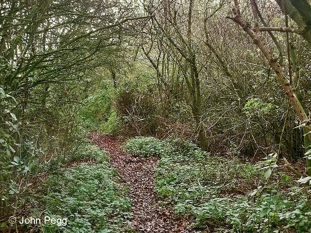
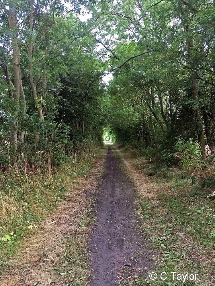
The ironstone mines were all opencast and had their own private railway systems, which were narrow gauge tramways in earlier times. There were loading points and exchange sidings at several locations on the branch. No regular passenger services were ever operated. The branch closed between 1974 and 1977 as ironstone mining ceased. By early in 1980 all the track had been removed. Today some of the trackbed is part of the National Cycle Network's Route 15.
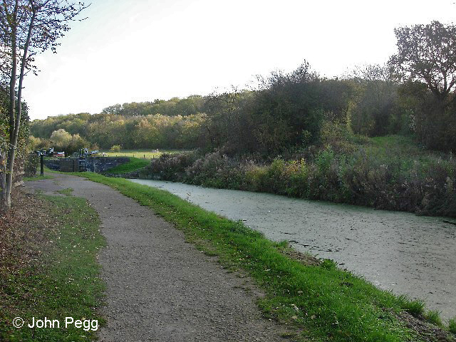
As a comparative latecomer to the local transport infrastructure the railway had to thread its way through existing landscape features, both natural and man-made. The River Devon was crossed twice and several roads, ancient lanes and footpaths were intersected, requiring bridges or gated crossings. For much of its length this northern section of the branch runs side-by-side with the Grantham Canal. Both the railway and the canal ascended towards Woolsthorpe, but the railway climbed more rapidly. Near the south end of the section there was a bridge, later replaced by an embankment, which took the line over the canal.
John has captured evidence of most of these crossings in the photographs.
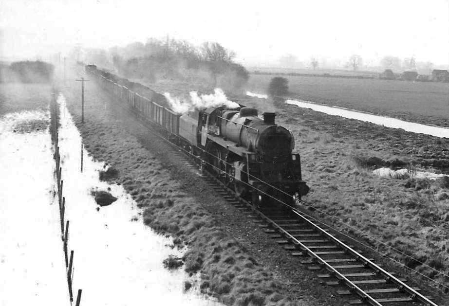
The header photograph (above) shows an ironstone train travelling north on the branch on 28th April 1966. It is passing one of the Stenwith locks of the then disused Grantham canal. At bottom right is the 1¼ milepost from Belvoir. The locomotive is No. 76085 of Colwick shed in Nottingham.
Photograph taken by Noel Ingram.
The location of the junction at Belvoir, near Muston, looking along the line of the branch as it converged with the Grantham to Nottingham line on the right.
Stepping into our Tardis for the first time on this walk...
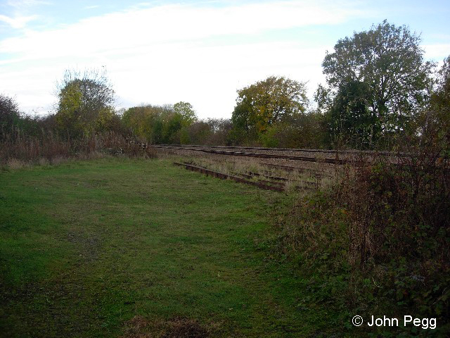
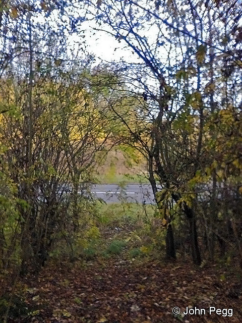
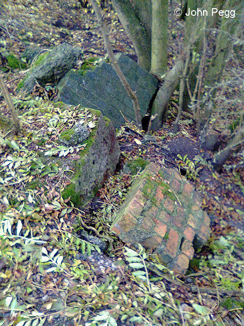
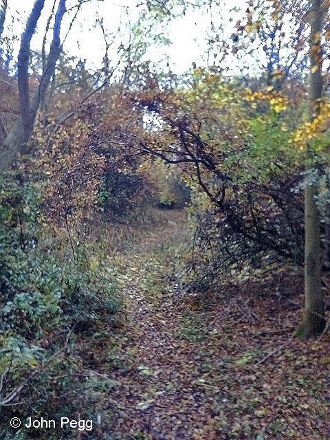
An ironstone train leaves from the down siding at Belvoir towards Bottesford on 27th March 1966, hauled by class B1 No. 61089. It will take the crossover seen between the two poles on the left to gain the down main line. The photographer is standing on the first few yards of the Woolsthorpe Branch. Photograph by Noel Ingram.This is the site of bridge number 1, which took the branch over the A52 Grantham to Nottingham road. The photo was taken from line level looking north, towards Belvoir.Brickwork nearby - could it have been part of number 1 bridge?The track bed south of bridge No. 1. This section is not used much for walking.
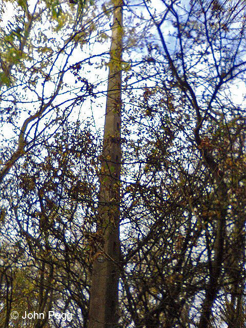
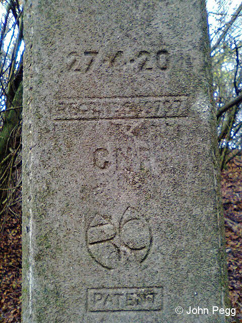
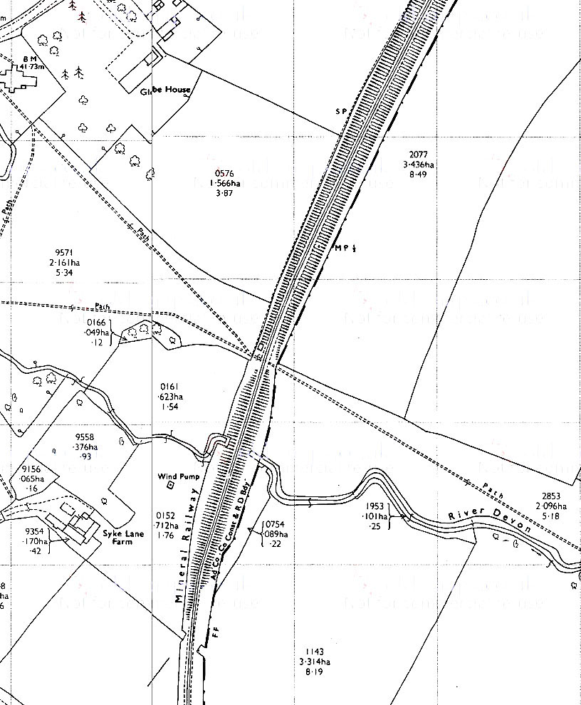
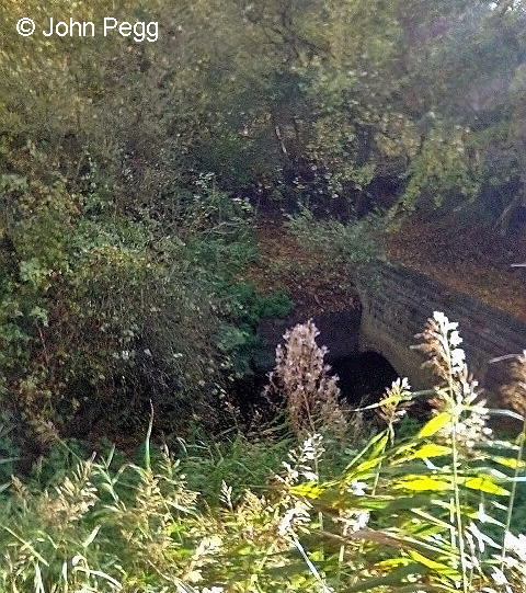
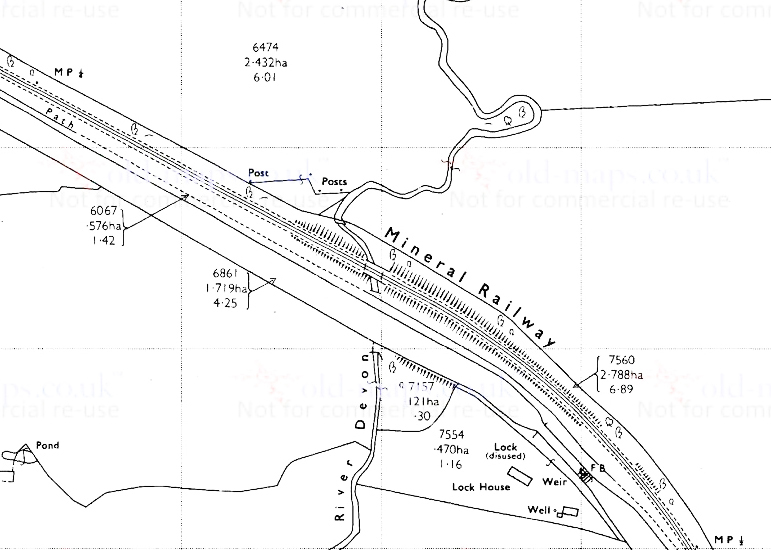
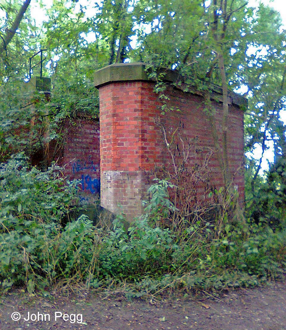
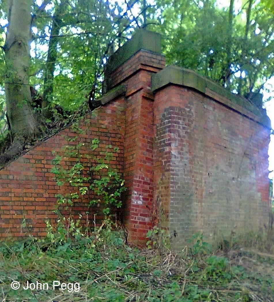
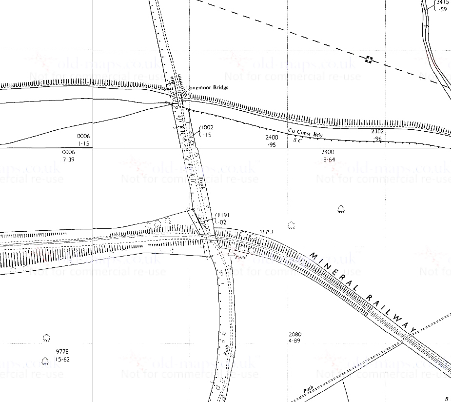
A map of the junction at Belvoir in the early 1970s, showing: o top centre - the branch, on a curved embankment, diverging from the Grantham-Nottingham line o centre right - the bridge over the A52; there's a photograph taken looking west here o the line heads south in a cutting. Maps are dated 1970 unless otherwise noted.This is a copy of the diagram which shows the arrangement of the tracks, points and signals controlled by the 26 levers in Belvoir signal box. The number against each signal or set of points identified the lever that operated it. The signalman's main task at Belvoir was to arrange for trains of ironstone from the Woolsthorpe Branch to continue in either direction - towards Bottesford or Allington Junction - as required, and to receive incoming incoming trains of empty wagons, also from either direction. In the case of traffic to and from the east this involved the locomotive 'running round' its train. Trains going to and from the branch had to be kept clear of the main lines, using the up and down sidings, to avoid delay to passenger and freight services passing through.This concrete signal post survives from the railway, nearly half a mile from the junction. The post carried a 'fixed' distant signal, cautioning the drivers of trains on the branch as they approached the junction with the Grantham to Nottingham line (for this information we're grateful for the comment below).Signal post inscription, cast into the concrete. Coming up for 100 years old. The monogram is 'MRC' standing for 'Marriott Reinforced Concrete'. William Marriott was the manager of the Midland & Great Northern Joint Railway's workshops at Melton Constable in Norfolk, where he established a concrete works for producing railway equipment normally made from timber. A great number of signal posts were produced at Melton Constable for the M&GN, GCR, MR and GNR. Ellis & Sons of Leicester were licensed to produce more. The materials were cement, sand and small gravel aggregate, the latter two materials quarried locally at Kelling Heath and Holt. The first signal post was erected in 1915, and they were produced right up to the time the Melton Constable Works were closed in December 1936. (Nigel Digby on 'The Signal Box' forum, 31 Oct 2013)The view of the signal that drivers approaching the junction would have had - without the bushes, of course!The same view from further south. Notice that we are in a cutting here.Soon after the signal post the line emerges from the cutting onto a short embankment. Here we find Bridge No. 2, over the River Devon. In December 2019 Brian Maddison dropped us a line to say, "In 1964 I joined BR Engineers at Peterborough. One of my first jobs was to be part of the team that reconstructed Bridge 2 on the Woolsthorpe Branch from a timber trestle bridge to the Armco multi-plate arch that still exists today."
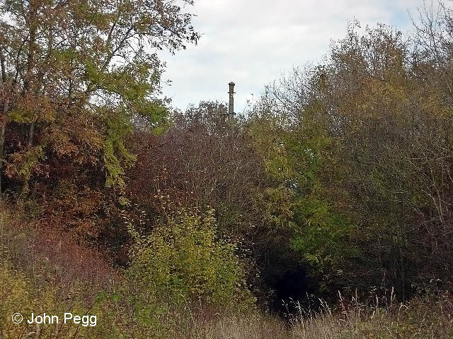
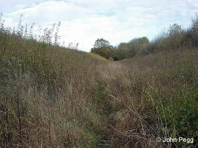
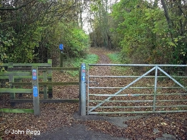
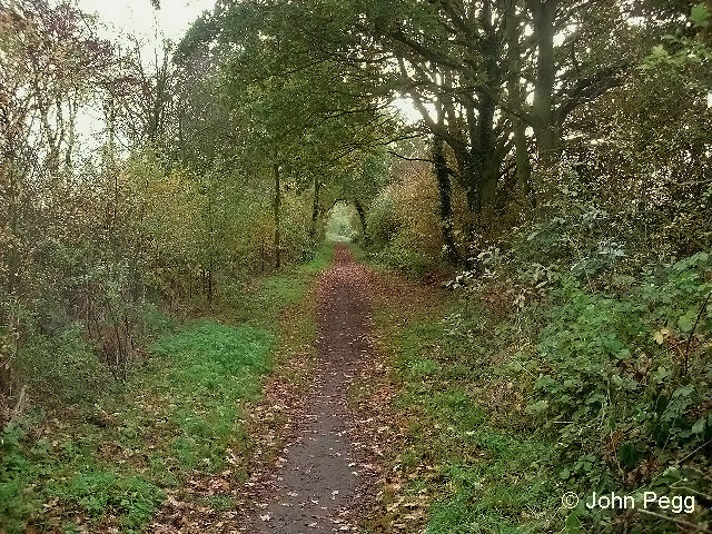
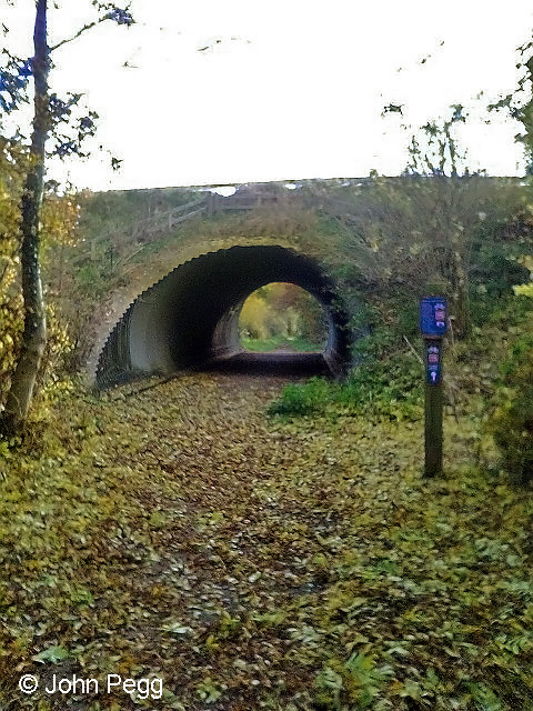
The cutting leads in from top right. The small letters 'SP' identify the location of the concrete signal post. Further south is the bridge or culvert which carries the River Devon through the railway embankment.This section of the old branch line is quite overgrown......but not far after we've crossed the River Devon, from the point where we meet Woolsthorpe Lane, Sutrans has created a cycleway and footpath. It's part of Route 15 of the National Cycle Network which will, when complete, link Shepshed in Leicestershire with Coningsby in Lincs. via Nottingham, Grantham and Sleaford.Much easier walking along this stretch.The Grantham Canal is now alongside us on our right. Both canal and railway crossed the River Devon here. The railway bridge has gone - it spanned the gap is in front of us - and a diversion is in place for cyclists and walkers. On the right the bridge under the canal can be seen.
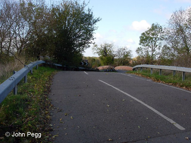
The canal and the railway both cross the River Devon. Note the canal lock at bottom right, which shows that the land is gradually ascending here.Woolsthorpe Lane crosses above. This is a new 'cycleway-sized' overbridge - trains couldn't get through here now!Woolsthorpe Lane above the bridge. Note the bridge beyond, over the canal. The canal bridge is marked 'Stenwith Bridge' on the map.
Now step once more into your time machine and look left...
An ironstone train approaching the Woolsthorpe Lane bridge at Stenwith on 5th March 1966. The locomotive is No. 76051 of Colwick shed in Nottingham. Photograph used with permission from David Creasey.
Check there's no traffic on the road, cross to the other side of the bridge and breathe in the smoky aroma...
An ironstone train passing beneath the bridge at Stenwith on 5th March 1966. The locomotive is No. 76051 of Colwick shed in Nottingham. Photograph used with permission from David Creasey.
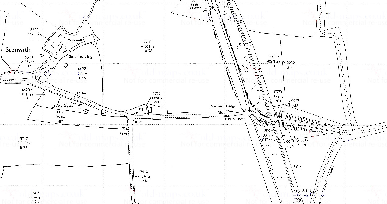
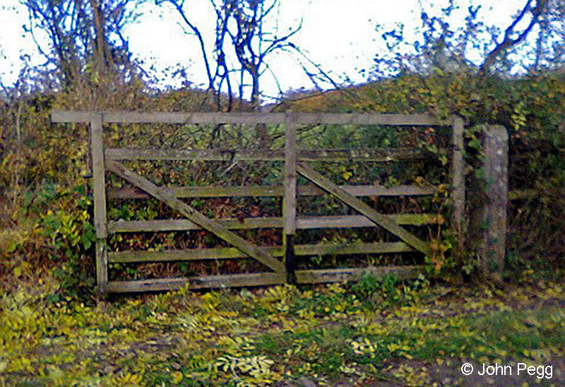
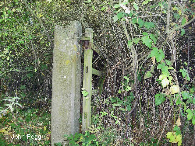
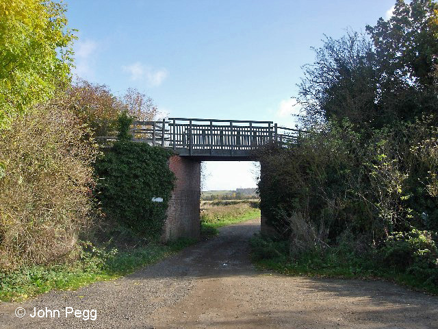
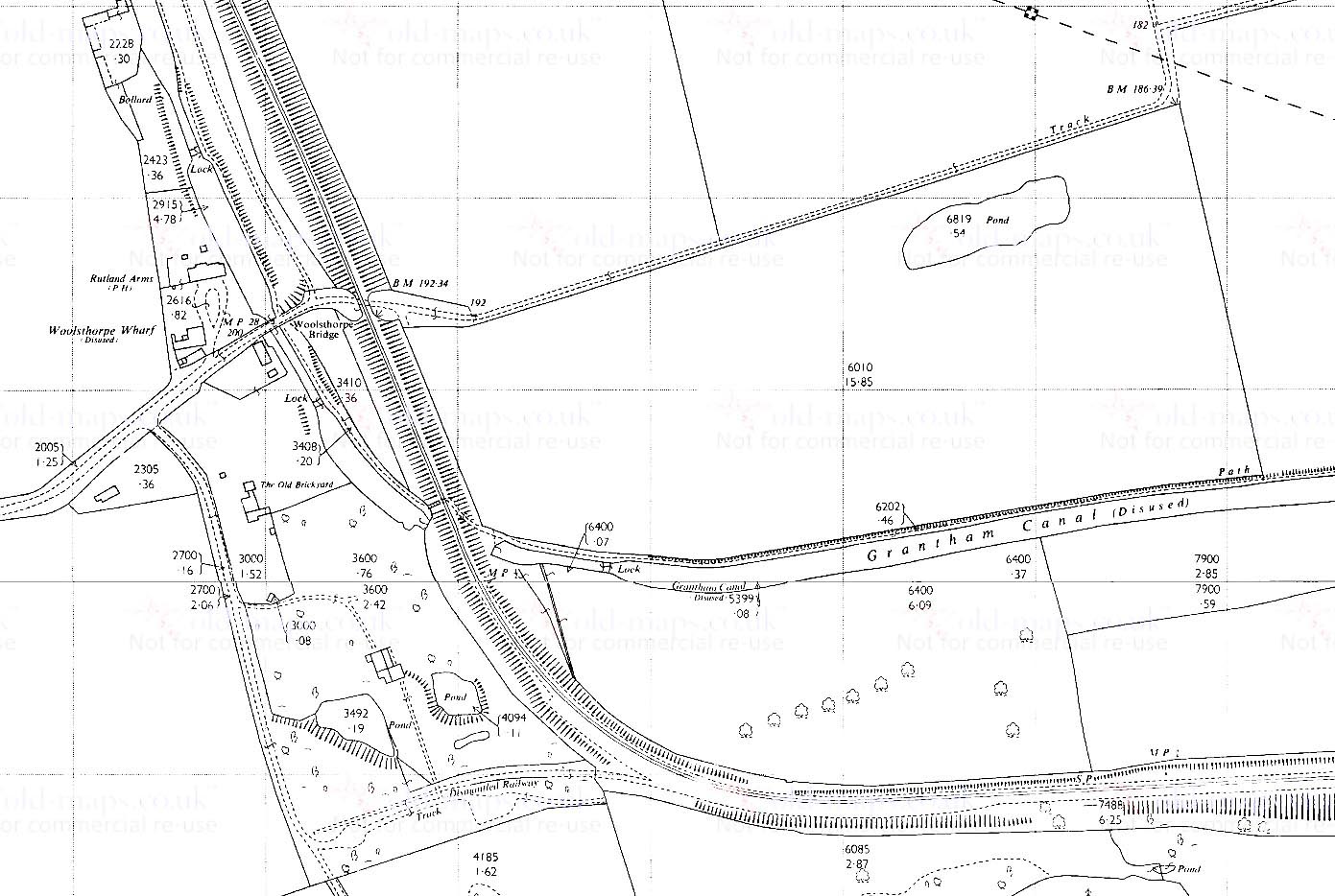
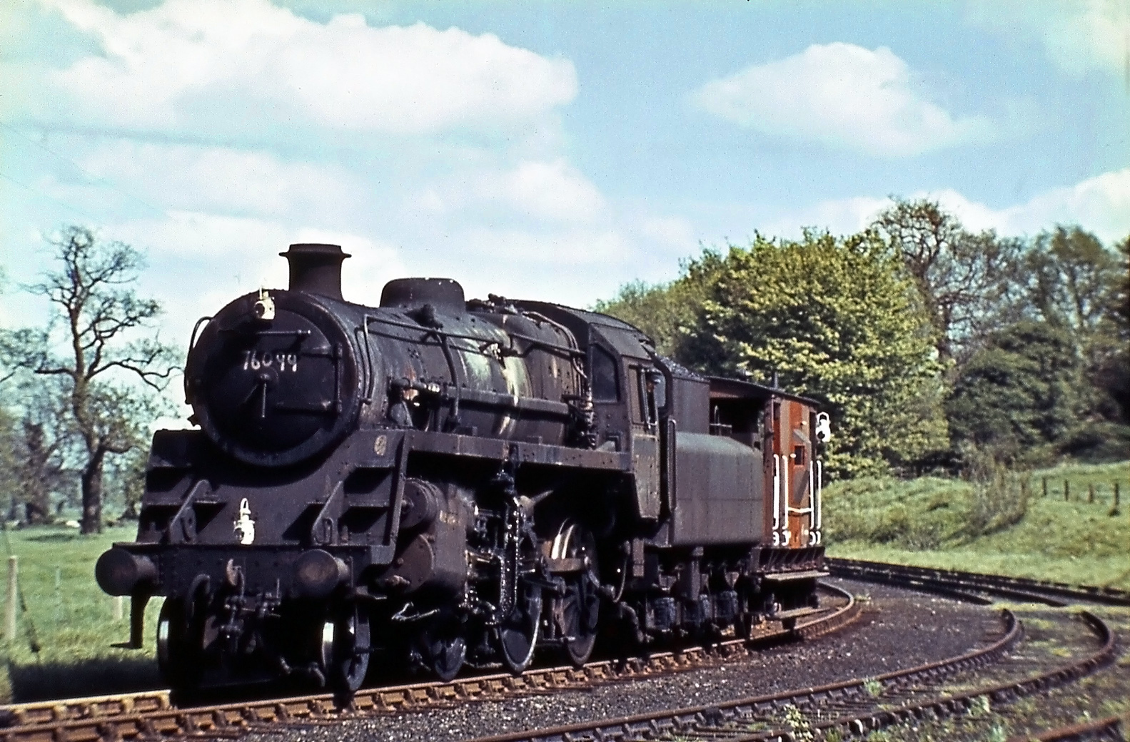
Near Stenwith, Woolsthorpe Lane crosses both the Grantham Canal and the Denton Branch mineral railway.On Saturday 9th September 1961 the Railway Correspondence & Travel Society (RCTS) East Midlands Branch arranged a Rail Tour from Nottingham along the Woolsthorpe Branch. Here the special train has just passed under the road bridge near Stenwith. Another photograph from this trip appears in Part 3. Photograph taken by Humphrey Platts.There are numerous farm crossing gates with original sturdy concrete posts, most likely made at the Meton Constable concrete works....another gatepost....until we come to the site of Woolsthorpe Wharf, where Bridge No. 5 takes the cycle track over a lane. This is a lightweight bridge which uses the original railway abutments. The Dirty Duck pub (also known as The Rutland Arms) is over my left shoulder.Here is where the line used to cross the Grantham Canal on an angle, from hard on our left to the gap in the bushes on the far side. There was originally a wooden trestle bridge here, but after the canal was abandoned as a navigable waterway the railway converted it into an embankment with pipes running through to maintain water flow. There is more on the history of this site in the Grantham Canal Society's Bridge newsletter for March 2017 (on page 4). There's another lock on the canal in the distance, showing that the land continues to ascend gradually. We are 2½ miles from Belvoir here. With the canal no longer crossable here (unless you're training for a triathlon!) we take the towpath beyond the lock to Longmoor Lane, where there is an old humpback bridge over the canal. Turn right over the canal and re-join the railway where it used to cross the lane - see the photo of Bridge No. 7 below.This map shows the road underbridge near Woolsthorpe Wharf on the Grantham Canal and the embankment crossing the canal, with the water flowing through it in a culvert - Bridge No. 6. To the west of the branch, as it begins to curve after crossing the canal, there used to be a brickworks, which was served by a siding marked 'Dismantled Railway'. Bricks for the seven nearby locks on the Grantham Canal (the Woolsthorpe Flight) had been made here long before the railway arrived.Originally the terminus of the Woolsthorpe Branch was to be at sidings parallel with the Grantham Canal. This map, dated 1902, shows a loading point there which is served by a narrow gauge tramway which originates at a location called Brewer's Grave near Woolsthorpe.No. 76099 with a brake van at Woolsthorpe sidings in May 1966. Photograph by Noel Ingram.This is part of the brickwork of Bridge No. 7 which took the branch over Longmoor Lane - the west abutment and a central pier. This was a substantial two-span bridge. From the map below it appears that the narrower, west span may have been provided to preserve independent access to part of the Duke of Rutland's estate which lay south of the canal and would have been isolated by the construction of the railway.This is the east abutment of the Longmoor Lane bridge.The branch continues south east from Bridge No. 7 towards Casthorpe Junction, where the line to quarries at Harlaxton diverged.
The railway is a short distance south of the canal as they both cross Longmoor Lane, the lane passing over the canal but under the railway.
Longmoor Lane is an ancient drove road and it now forms part of the Viking Way, a long distance footpath which starts on the banks of the Humber, winding its way through Lincolnshire to finish on the shores of Rutland Water, a total of 235km (147 miles).
We hope you have enjoyed reading this page. Please take a moment to tell us how you discovered it and at the same time send us some feedback by using the comments section at the end of the article.
Copyright note: the article above is published with the appropriate permissions. For information about copyright of the content of Tracks through Grantham please read our Copyright page.
24 thoughts on “The Woolsthorpe Branch Rediscovered – Part 1”
Graham cloxton
The signal post that was in the cutting was a fixed distant. This was to make the drivers aware they were approaching Belvoir Jct., so they could reduce speed after pulling hard up hill.
On 9th September 1961 the RCTS East Midlands Branch ran a railtour from Nottingham to visit the iron ore system at Harlaxton. A three-car diesel set was used via Belvoir Junction with transfer at Casthorpe to steam haulage on Stewarts and Lloyds lines. Details of this run over the Woolsthorpe Branch appear the the RCTS 'Railway Observer' for 1961. There are photos and I also have one of the diesel set and the steam train of wagons on S & L track. There were about 100 passengers.
It is also interesting to look at the rail crossing of the Grantham Canal below Woolsthorpe Top Lock. The original bridge was at some time replaced with an embankment, which in turn has been removed during restoration of the Grantham Canal at this point. The Grantham Canal Society will no doubt have details of this project.
[Note: RCTS = The Railway Correspondence and Travel Society, founded in 1928 and still going strong today.]
As a walker myself and particularly of abandoned railway lines I thoroughly enjoyed this article, maps and photos. I have fond memories of the branch and adjoining private ironstone company lines and am now equipped to revisit when next in the Grantham area.
I guess that you may have read the Oakwood Press - Lincoln to Grantham Line via Honington by Stewart E Squires but just in case, as well as the abandoned line itself there are many ironstone branches, all worked out in the early part of the 20th Century, vestages of which still remain. I suspect some are within the notional eight miles of Grantham.
One of my old fishing haunts at Frieston is a remnant, as is a very fossiliferous side of a cutting near Caythorpe.
Thanks once again for the article. I wish that I lived near Grantham. The exploration appeals to me.
Richard
Thanks very much, I've enjoyed parts 1 and 2 and am looking forward to the Harlaxton section. From my experience they make very good walks or off-road cycle routes.
In addition to one or two of the original locomotives, I think that the Harston engine shed shown on the map at the end of part 2 is now at the Rutland Railway Museum.
I can recommend Eric Tonks's material on the route if you're unaware of it. He updated his original "Ironstone Railways and Tramways of the Midlands" from 1959 in a series of area-specific books about 30 years later - "The Ironstrone Quarries of the Midlands" (Part VIII - South Lincolnshire) in 1991 covered Harlaxton, while Woolsthorpe was covered in Part IX Leicestershire in 1992. Both are excellent, as is the original 1959/1961 version.
Thanks Martin,
I'll make sure John's aware of your interest, I'm sure he'll appreciate the comment. I don't have copies Eric Tonks's books, but they may become a belated Christmas present to myself!
John Clayson
Thanks for the credit, John. I am really pleased to see an MRC post still standing! So many of them were thrown over and broken. The GNR stamp by the date is to tell the concrete shop foreman, when selecting a post to send to site, which holes are provided in the casting at the top. The holes for the GN-type tumbler or somersault signal fittings were different for those required for MR or GCR fittings. Keep up the good work. Nigel
Hello Nigel,
Thank you for your comment - credit where credit's due. Also the info about the 'GNR' stamp. When I first saw the photograph I remember thinking "How the dickens am I going to find out what all this means?" At first I could make out neither the monogram nor the patent number. If I recall I kind of made some guesses of the indistinct patent number and put them, and the word 'concrete', into a search engine, which eventually led me to your post.
John
As a resident of Muston for forty years, I enjoyed being taken back along the old rail track that I knew so well. We used to play football as children in the field opposite the 'Gap' public house (shown as The Wheatsheaf on your map), and I remember seeing the smoke and steam being pumped out of the engines as they climbed through the cutting towards the bridge over the A52, pulling a full load of ore wagons, before joining the main line at the Belvoir junction. By the way, your readers may not be aware that the 'Belvoir' mentioned throughout your article refers I believe to this junction at Muston, not the village wherein lies the imposing castle bearing the same name, situated a mile east of Woolsthorpe, which is also included.
The canal which runs alongside the line is at present undergoing restoration at Stenwith, and may be of interest to those with industrial heritage at heart.
Hello Ralph,
Thank you for adding further interest to to our page about the Woolsthorpe Branch with your memories of seeing the trains from a nearby field.
I'm grateful that you've drawn my attention to the distinction between the 'railway' location known as 'Belvoir' and the village itself - thank you for your local insight. I know that 'Belvoir' signal box existed near Muston before the branch was built. I don't know specifically why it was not called 'Muston' - though it's quite possible, speaking speculatively, that the Great Northern Railway felt that naming even a mere signal box, if not a station, after of the Duke of Rutland's home and estate would stand them in good stead. I was tempted to refer to the location as 'Belvoir Junction' but, as you'll see from the signal box diagram, 'Belvoir' always seems to have been the official name of the signal box, and hence the location, from the railways' perspective. I'll add an explanatory sentence to the article.
We're in touch with the Grantham Canal Society and I'm following the work on the Woolsthorpe flight of locks through their Bridge newsletter. I'd be interested to see any photographs, or other kinds of image, of a wooden trestle bridge which I understand used to take the branch line over the canal when it was previously navigable, before the later embankment (recently removed) was constructed. I wonder if you are aware of any?
With thanks again,
John Clayson
The sidings for the brickworks near Bridge 6 at Woolsthorpe were also used by the Duke of Rutland to transport Dogs and Horses from the Belvoir Hunt to distant locations. The remains of the wooden platform are still there.
I have a photo of the Railway Bridge next to the Muston Gap pub which crossed the A52 road. The section of road from Bottesford to the railway bridge was known locally as the dreaded Muston Bends. Road accidents happened regularly before the road was eventually straightened.
Thank you very much for getting in touch. If it's possible to send a scan of your photograph, with your permission we will be delighted to add it to the page. I will contact you separately with an email address.
Thank you Richard. It's very interesting to read about the locality from someone who knew it well. I've added a link to that page in the caption for the map where the bridge is shown.
John Clayson
Discovered whilst following the history of its use in 1894 to transport the coffin of the eldest son of the Duke of Rutland to the castle from Grantham. Mentioned in the "The Secret Rooms" by Catherine Bailey an excellent book of the history of the Rutlands in the late Victorian era and through to the modern day with contributions from the current Duchess.
Hello Ted,
Thank you for getting in touch with information about the use of the siding at Woolsthorpe. You might be interested to know that a GNR internal circular has recently been published, on the rear cover of Great Northern News, the members' newsletter of the Great Northern Railway Society. The circular is dated 29th September 1900 and it refers to special trains, from Woolsthorpe to Claypole and Ancaster (and return), in connection with two meets of the Belvoir hounds early in October 1900. The issue is No. 239 (on page 239.24) and there's an item of correspondence about the public siding at Woolsthorpe in No. 241 on page 241.07.
Thanks again and best wishes,
John Clayson
I'm so interested in stuff like this. I grew up on a farm in the village of Tithby and have been exploring since I can remember. I'm always studying maps and have found several tunnels and old train lines which I plan to explore. I was hoping for information like this and if you know of any walking apps that take in the disused lines I'd love to hear from you. Good on Sustrans, I hope that more of the disused sections can be enjoyed and remembered, it's the perfect way to use these lines so that they are not lost forever.
Hello Rebecca,
We're pleased to hear that you're enjoying Railways Rediscovered on Tracks through Grantham.
I can’t help with recommendations of apps, but one of the more spectacular recent additions to old railway routes brought back into use for walkers and cyclists has been the Bennerley Viaduct. I haven’t seen it myself yet, but if you still live not too far away I’m sure it’s well worth a visit.
Best wishes,
John Clayson
We are in our caravan for a week at Casthorpe. Though only 38 miles from our home in Derby, we knew nothing about this railway. During the week we have walked most of it and this website was just brilliant in guiding us. Many thanks for whoever put it all together.
Hello Kerry,
It's really good to hear that our pages tracing the remains of the Woolsthorpe Branch have helped you to explore and enjoy the local countryside while on holiday. It was John Pegg who walked and photographed the line a few years ago carrying out the survey for us. I'll let him know that his efforts are still being appreciated.
Best wishes,
John Clayson


The signal post that was in the cutting was a fixed distant. This was to make the drivers aware they were approaching Belvoir Jct., so they could reduce speed after pulling hard up hill.
Thanks for the information Graham. I'll add that to the article.
John Clayson
On 9th September 1961 the RCTS East Midlands Branch ran a railtour from Nottingham to visit the iron ore system at Harlaxton. A three-car diesel set was used via Belvoir Junction with transfer at Casthorpe to steam haulage on Stewarts and Lloyds lines. Details of this run over the Woolsthorpe Branch appear the the RCTS 'Railway Observer' for 1961. There are photos and I also have one of the diesel set and the steam train of wagons on S & L track. There were about 100 passengers.
It is also interesting to look at the rail crossing of the Grantham Canal below Woolsthorpe Top Lock. The original bridge was at some time replaced with an embankment, which in turn has been removed during restoration of the Grantham Canal at this point. The Grantham Canal Society will no doubt have details of this project.
[Note: RCTS = The Railway Correspondence and Travel Society, founded in 1928 and still going strong today.]
As a walker myself and particularly of abandoned railway lines I thoroughly enjoyed this article, maps and photos. I have fond memories of the branch and adjoining private ironstone company lines and am now equipped to revisit when next in the Grantham area.
I guess that you may have read the Oakwood Press - Lincoln to Grantham Line via Honington by Stewart E Squires but just in case, as well as the abandoned line itself there are many ironstone branches, all worked out in the early part of the 20th Century, vestages of which still remain. I suspect some are within the notional eight miles of Grantham.
One of my old fishing haunts at Frieston is a remnant, as is a very fossiliferous side of a cutting near Caythorpe.
Thanks once again for the article. I wish that I lived near Grantham. The exploration appeals to me.
Richard
Hello Richard,
Thank you for your suggestions for further exploration. I'm aware of Stewart Squires' book but I haven't a copy - I'll need to get hold of one.
I hope you have a good Christmas and New Year.
John
Thanks very much, I've enjoyed parts 1 and 2 and am looking forward to the Harlaxton section. From my experience they make very good walks or off-road cycle routes.
In addition to one or two of the original locomotives, I think that the Harston engine shed shown on the map at the end of part 2 is now at the Rutland Railway Museum.
I can recommend Eric Tonks's material on the route if you're unaware of it. He updated his original "Ironstone Railways and Tramways of the Midlands" from 1959 in a series of area-specific books about 30 years later - "The Ironstrone Quarries of the Midlands" (Part VIII - South Lincolnshire) in 1991 covered Harlaxton, while Woolsthorpe was covered in Part IX Leicestershire in 1992. Both are excellent, as is the original 1959/1961 version.
Happy New Year! Martin
Thanks Martin,
I'll make sure John's aware of your interest, I'm sure he'll appreciate the comment. I don't have copies Eric Tonks's books, but they may become a belated Christmas present to myself!
John Clayson
Thanks for the credit, John. I am really pleased to see an MRC post still standing! So many of them were thrown over and broken. The GNR stamp by the date is to tell the concrete shop foreman, when selecting a post to send to site, which holes are provided in the casting at the top. The holes for the GN-type tumbler or somersault signal fittings were different for those required for MR or GCR fittings. Keep up the good work. Nigel
Hello Nigel,
Thank you for your comment - credit where credit's due. Also the info about the 'GNR' stamp. When I first saw the photograph I remember thinking "How the dickens am I going to find out what all this means?" At first I could make out neither the monogram nor the patent number. If I recall I kind of made some guesses of the indistinct patent number and put them, and the word 'concrete', into a search engine, which eventually led me to your post.
John
As a resident of Muston for forty years, I enjoyed being taken back along the old rail track that I knew so well. We used to play football as children in the field opposite the 'Gap' public house (shown as The Wheatsheaf on your map), and I remember seeing the smoke and steam being pumped out of the engines as they climbed through the cutting towards the bridge over the A52, pulling a full load of ore wagons, before joining the main line at the Belvoir junction. By the way, your readers may not be aware that the 'Belvoir' mentioned throughout your article refers I believe to this junction at Muston, not the village wherein lies the imposing castle bearing the same name, situated a mile east of Woolsthorpe, which is also included.
The canal which runs alongside the line is at present undergoing restoration at Stenwith, and may be of interest to those with industrial heritage at heart.
Hello Ralph,
Thank you for adding further interest to to our page about the Woolsthorpe Branch with your memories of seeing the trains from a nearby field.
I'm grateful that you've drawn my attention to the distinction between the 'railway' location known as 'Belvoir' and the village itself - thank you for your local insight. I know that 'Belvoir' signal box existed near Muston before the branch was built. I don't know specifically why it was not called 'Muston' - though it's quite possible, speaking speculatively, that the Great Northern Railway felt that naming even a mere signal box, if not a station, after of the Duke of Rutland's home and estate would stand them in good stead. I was tempted to refer to the location as 'Belvoir Junction' but, as you'll see from the signal box diagram, 'Belvoir' always seems to have been the official name of the signal box, and hence the location, from the railways' perspective. I'll add an explanatory sentence to the article.
We're in touch with the Grantham Canal Society and I'm following the work on the Woolsthorpe flight of locks through their Bridge newsletter. I'd be interested to see any photographs, or other kinds of image, of a wooden trestle bridge which I understand used to take the branch line over the canal when it was previously navigable, before the later embankment (recently removed) was constructed. I wonder if you are aware of any?
With thanks again,
John Clayson
The sidings for the brickworks near Bridge 6 at Woolsthorpe were also used by the Duke of Rutland to transport Dogs and Horses from the Belvoir Hunt to distant locations. The remains of the wooden platform are still there.
Hello Mike,
Thank you for that piece of information; the platform would be worth a short detour to search out when exploring the route.
John Clayson
I have a photo of the Railway Bridge next to the Muston Gap pub which crossed the A52 road. The section of road from Bottesford to the railway bridge was known locally as the dreaded Muston Bends. Road accidents happened regularly before the road was eventually straightened.
Hello Roger,
Thank you very much for getting in touch. If it's possible to send a scan of your photograph, with your permission we will be delighted to add it to the page. I will contact you separately with an email address.
John Clayson
There is also a photograph of that bridge here:
http://www.bottesfordhistory.org.uk/content/catalogue_item/bottesford-local-history-archive/pictures-from-mr-melvin-bradburys-collection/mineral-line-bridge-over-a52-at-muston
It will need permission to use I suspect.
Thank you Richard. It's very interesting to read about the locality from someone who knew it well. I've added a link to that page in the caption for the map where the bridge is shown.
John Clayson
Discovered whilst following the history of its use in 1894 to transport the coffin of the eldest son of the Duke of Rutland to the castle from Grantham. Mentioned in the "The Secret Rooms" by Catherine Bailey an excellent book of the history of the Rutlands in the late Victorian era and through to the modern day with contributions from the current Duchess.
Hello Ted,
Thank you for getting in touch with information about the use of the siding at Woolsthorpe. You might be interested to know that a GNR internal circular has recently been published, on the rear cover of Great Northern News, the members' newsletter of the Great Northern Railway Society. The circular is dated 29th September 1900 and it refers to special trains, from Woolsthorpe to Claypole and Ancaster (and return), in connection with two meets of the Belvoir hounds early in October 1900. The issue is No. 239 (on page 239.24) and there's an item of correspondence about the public siding at Woolsthorpe in No. 241 on page 241.07.
Thanks again and best wishes,
John Clayson
I'm so interested in stuff like this. I grew up on a farm in the village of Tithby and have been exploring since I can remember. I'm always studying maps and have found several tunnels and old train lines which I plan to explore. I was hoping for information like this and if you know of any walking apps that take in the disused lines I'd love to hear from you. Good on Sustrans, I hope that more of the disused sections can be enjoyed and remembered, it's the perfect way to use these lines so that they are not lost forever.
Hello Rebecca,
We're pleased to hear that you're enjoying Railways Rediscovered on Tracks through Grantham.
I can’t help with recommendations of apps, but one of the more spectacular recent additions to old railway routes brought back into use for walkers and cyclists has been the Bennerley Viaduct. I haven’t seen it myself yet, but if you still live not too far away I’m sure it’s well worth a visit.
Best wishes,
John Clayson
We are in our caravan for a week at Casthorpe. Though only 38 miles from our home in Derby, we knew nothing about this railway. During the week we have walked most of it and this website was just brilliant in guiding us. Many thanks for whoever put it all together.
Hello Kerry,
It's really good to hear that our pages tracing the remains of the Woolsthorpe Branch have helped you to explore and enjoy the local countryside while on holiday. It was John Pegg who walked and photographed the line a few years ago carrying out the survey for us. I'll let him know that his efforts are still being appreciated.
Best wishes,
John Clayson